
Only 7 more stations to go!
Only 7 more stations to go!
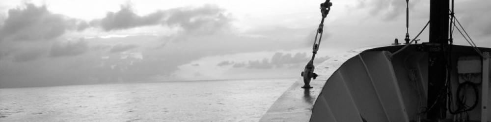
We are currently at one of our most exciting stations across the basin, the Mid-Atlantic Ridge. If you look closely at our position on the map posted below you’ll notice a light blue line (indicating higher elevation) running down the middle of the Atlantic between North/South America and Europe/Africa. This is the Mid-Atlantic ridge, a divergent boundary where two plates are spreading in opposite directions, one to the east and one to the west. As the two plates spread apart, molten magma from Earth’s crust rises, cools and spreads to create new ocean floor. This process is very slow and the ridge is estimated to widen only a few centimeters per year.
Hydrothermal vents (pictured below), which are like underwater volcanoes, also form at the ridge. When cold bottom water comes in contact with hot magma it dissolves minerals and metals in Earth’s crust and shoots up through vent fields at the ridge. Some of the minerals precipitate creating black or white chimneys where the water spills out. Plumes of hot mineral/metal rich water travel from the vents around the ridge which is what we are trying to sample. Chief Scientists have been searching all night, taking their time to make sure we catch the plume. Most of the metals analyzed throughout the cruise have been in the ocean for decades, but seawater from these hydrothermal vents contain a new source of metals that have only been in the water for a matter of days.

 The little red dot in the middle of the Atlantic is the R/V Knorr! A little more than halfway across the basin.
 Another Minke whale, just checking things out!
 We’ve had some spectators here at Station 14…a couple of Minke whales have been hanging around the Knorr all day today. They’ve been swimming around and underneath the boat and were particularly interested in the particle pumps.
 One of the Minke whales belly up, getting ready to dive under the boat.
 Happy thanksgiving from the R/V Knorr! I just finished dinner and am now ready to slip into a food induced coma. The ship’s kitchen staff had their hands full cooking turkey, ham, halibut and all of the fixings for about 50 people. Even though we followed our normal on-station routine, today still felt special. There was quite a group effort this morning to get our XM Satellite radio antenna high enough to catch a signal for today’s football games…unsuccessful but there is one van on a higher deck with a strong enough signal. Hope everyone had a great day 🙂

Water in the ocean is constantly moving – cold dense water from the poles sinks and migrates towards the equator as warm water from the equator flows towards the poles. Global winds patterns, gravity and the rotation of the Earth all play a role in how water moves in the surface ocean. The area that we are currently sampling in is part of the North Atlantic subtropical gyre or Sargasso Sea. Four currents surrounding the gyre move water in a clockwise circular direction creating a giant pool that is 2000 miles long and 700 miles wide. Sargassum, a brown floating seaweed, collects within the calm interior of the gyre which is why it is called the Sargasso Sea. Sargassum provides food and shelter for juvenile fish species and is an important habitat for many marine organisms.

We decided not to return to Bermuda to repair the freezer van, and to ride out the next three weeks with our fingers crossed that the system does not fail. The compressors seem to be working, but one of two fans is down which is why the temperature initially dropped. We will be very quick about entering the van for the remainder of the trip in order to keep it as cold as possible without overworking the one remaining fan. This means strapping on a headlamp and closing the freezer door behind you when loading samples (brrrrr…) while having another person outside to watch the door. The ship’s electrician and engineers are constantly monitoring the temperature and the science party has a back-up plan of where to relocate samples if the van should fail. We will install a replacement fan in Cape Verde (our final stop) to ensure that the van remains frozen as the Knorr travels back to Woods Hole for off loading in December.
The Knorr is currently steaming towards station 12, after completing station 11 early this morning. We have finished both sections within continental margins (Portugal to Cape Verde in 2010, and Woods Hole to Bermuda 2011) and are excited to finally be connecting the two by crossing open waters. We’ve had some pretty nice weather the last few days, warm and sunny. I’ve been stuck in the lab analyzing samples but sometimes I have about 20 minutes of down time where I sneak outside to catch some sun. Yesterday during one of these breaks I was lucky enough to see a pod of dolphins swimming along with the boat, I tried to snap a picture but they were too fast!
In true GEOTRACES fashion, a major problem has developed. Not as serious as last year (in 2010 a drive shaft that operates one of the ship’s propellers broke, forcing us to end the cruise early), but still a big issue. While we have a handful of people like myself doing onboard analysis, we also transport thousands of samples back to the US to distribute to various labs. During the cruise, samples are stored in a “freezer van” which is essentially a freezer the size of a box truck that sits on deck. Pulling away from Bermuda we realized that the van was not working properly and we do not have the right parts to fix it. Without the van there are a number of samples from the remainder of the cruise that are in jeopardy. The Chief Scientists had to make a quick decision and our current plan is to complete station 10 (this will take 1-2 days) and then head back into port in Bermuda on Monday. Hopefully by Monday we can have the right parts or a new van to swap out and then be back on track.
